Good Monday afternoon bloggers,
That was a wild few hours this morning as we tracked strong to severe thunderstorms that produced hail mostly to pea and quarter sized around here. There was a last line that brought 40-70 mph winds around noon to locations south of Kansas City.
This was Weather Track Radar at 11:35 AM. That is a bow echo extending from Gardner to Garnett. When you see these, strong winds are the main threat. If we were in the warm air, we could not have only seen a tornado embedded in this bow echo, but also in the cell east of the line, north of Fontana. You can see the small hook. We were protected from much bigger severe weather due to the fact we were in the colder air.

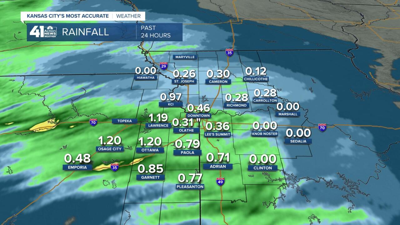
Rainfall was the heaviest from central Kansas to southern Missouri. KCI officially received close to 1" with most locations between .25" to 1". Northern MO saw the least. The 0.00" for Clinton and Sedalia are there as the main line had not hit when this image was captured. Hiawatha, KS did not report.

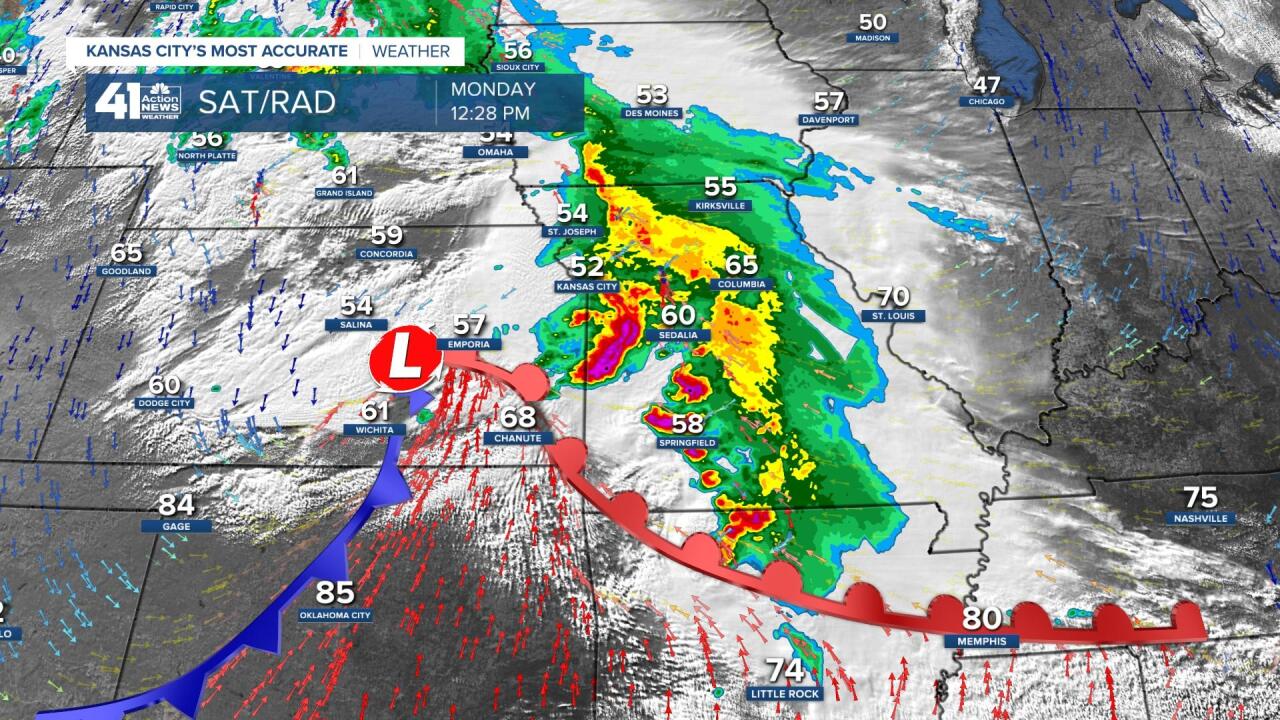
Here was the surface set up at 1230 PM. It was 85 at Oklahoma City, while we were 52. You can see all of the thunderstorms in the colder air. The south part of the last line touched the warm front and there was a brief tornado warning south of our viewing area. This area of rain and thunderstorms is now moving away. Where will the main threat of severe weather be located the rest of the day? What is next? Let's go through this.

MONDAY AFTER 4 PM: The bow echo we had this morning will be all the way in Tennessee by 8 PM. The main more serious severe weather threat will be found from southwest Missouri to eastern Oklahoma and northwest Arkansas. Look at the 4 PM set up! 56 in KC to 100 at OKC! That is the warm air and any thunderstorms that form on the fronts have the chance to be quite severe with tornadoes.

By 8 PM there are supercells along the front. We will see clouds and periods of showers and drizzle the rest of the day and evening.

TUESDAY MORNING: It will be a cloudy, breezy and cool night with some mist and drizzle. Lows will be around 50 with northwest winds 15-25 mph.

TUESDAY AFTERNOON: This system moves away and we are in for a nice afternoon with less wind, sunshine and highs around 70.

TUESDAY NIGHT-WEDNESDAY: A small system may bring a few rain showers 12-7 AM then it will be another nice day with highs 65-70.

Thursday and Friday will see another system that brings some rain followed by a May cold blast. Lows Saturday may drop to the 30s. We will update this on the Tuesday blog.
Have a great week and stay healthy.
"severe" - Google News
May 05, 2020 at 01:13AM
https://ift.tt/2L1pL12
Weather Weather Blog: Severe Threat for KC is Over for the Day Jeff Penner 1:13 - KSHB
"severe" - Google News
https://ift.tt/2OrY17E
Shoes Man Tutorial
Pos News Update
Meme Update
Korean Entertainment News
Japan News Update
Bagikan Berita Ini


0 Response to "Weather Weather Blog: Severe Threat for KC is Over for the Day Jeff Penner 1:13 - KSHB"
Post a Comment