

Leesburg #tornado ... pic.twitter.com/KIopePX3mk
— Ray (@thereelray) February 7, 2020
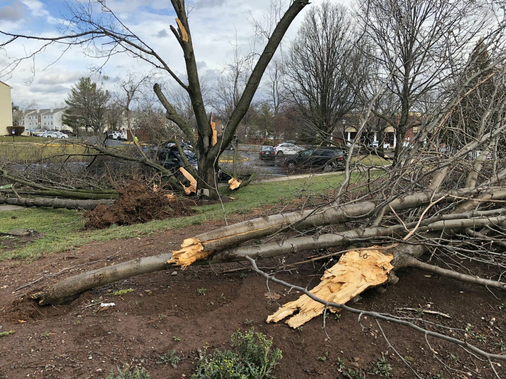
Trees down on Clark Ct in Leesburg. Lots of damage from high wind... pic.twitter.com/wUPoGvKJz3
— Megan McGrath (@MeganMcGrath4) February 7, 2020
@WTOP Plaza Street near Leesburg Elementary. pic.twitter.com/moPKByubAU
— Sarah Mullikin (@sarahemanns) February 7, 2020
Leesburg Va pic.twitter.com/rUTb1Rlmln
— victoria smothers (@itsmequeenvee) February 7, 2020
Stormy, cold and windy weather continues for Friday after an early morning of tornado and thunderstorm warnings that caused severe damage throughout the region.
The cold front has moved to the east, but strong winds will continue, with gusts up to 50 mph.
Here’s what you need to know.
- Thousands are without power on Friday.
- Wet ground and high winds could result in more downed trees.
- A wind advisory is in effect until 3 p.m.
- A cloudy, but dry weekend is ahead.
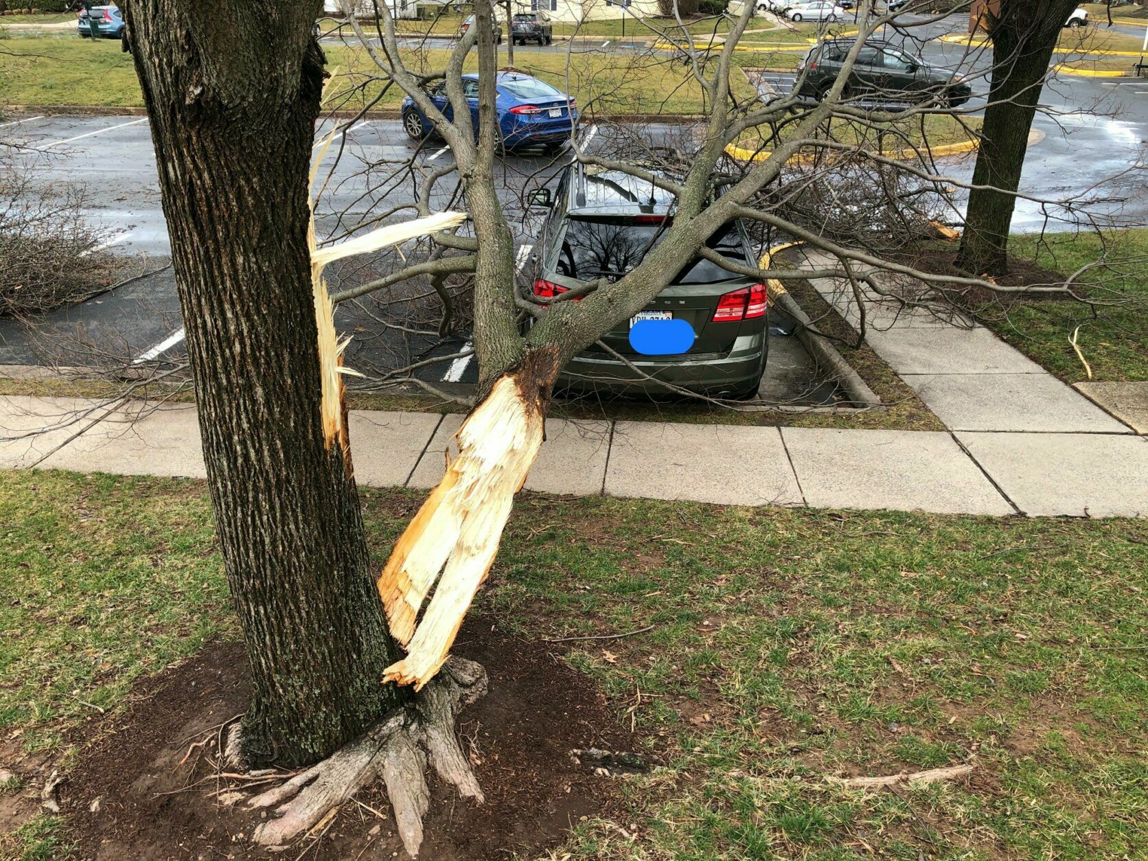
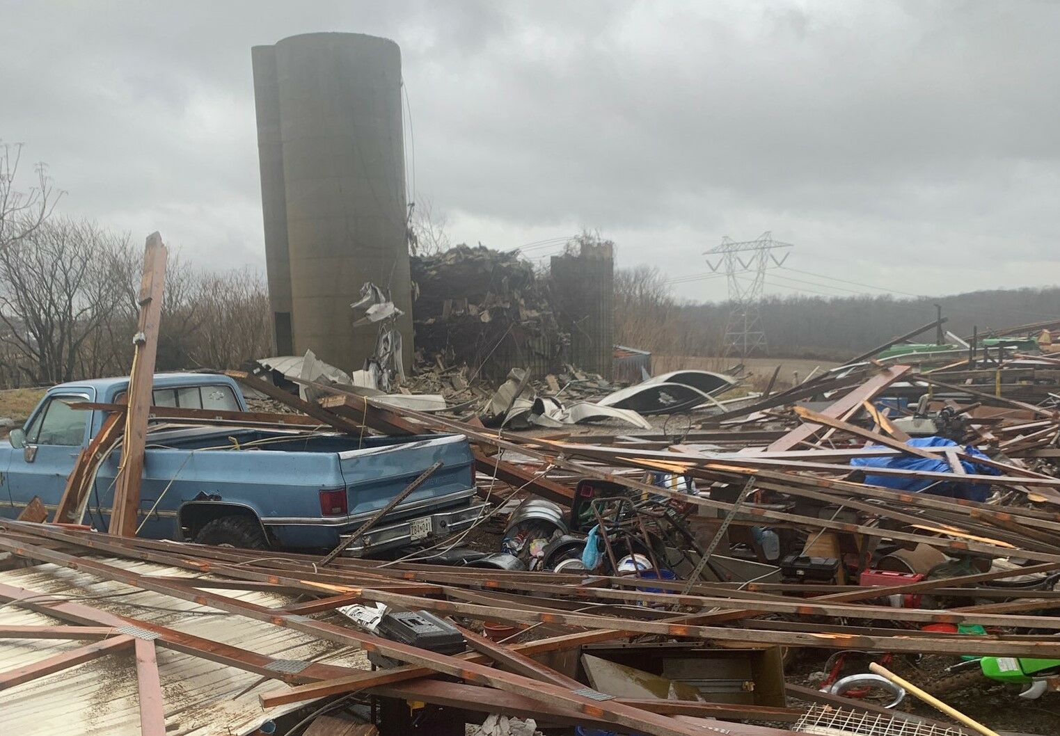
Severe wind and tree damage was reported in Leesburg, Virginia, after a possible tornado touched down, according to Storm Team4 meteorologist Matt Ritter. There was also damage in western Montgomery County, Maryland, after rain and winds passed through.
“We have seen a fair amount of damage across the area,” National Weather Service meteorologist Kyle Pallozzi said.
Pallozzi said that trees and wires blocked several roads in northeastern Loudoun County, including Leesburg, as well as in western Montgomery County. He added that this type of storm during the winter in the area is not very common.
“We can get tornadoes in February but also it’s not the most typical thing,” Pallozzi said.
Storm Team4’s Chuck Bell noted that February 7 was the earliest-ever tornado warning for the D.C./Baltimore area.
Kristi Rich, who lives in the area of Fieldstone Drive in Leesburg, said that she had just left the house when the storm hit, but that her husband told her he witnessed a “wall of water” that came through the rows of townhomes where they live.
“There’s a lot of debris, some downed trees and several homes had fencing damage,” Rich said. “One home in particular had the siding ripped off of the side of the home and you can see the attic.”
Montgomery County Fire and EMS spokesman Pete Piringer said Germantown, Poolesville, Boyds and Dickerson in Maryland were hit the hardest with several roads closed due to debris, wires and trees in the road.
Route 109 between I-270 and Frederick Road remained closed on late Friday morning after a branch crashed through the windshield of a car, just missing the driver, according to Piringer.
“Throughout all of this we have had a number of collisions, car crashes, large branches and trees falling on cars,” Piringer said. “It’s pretty significant damage.”
He said that were no injuries reported.
Officer Michael Drogin with Leesburg police said heavy rain and winds were not a great combination in the area, with trees down throughout the town. Crews have been dispatched. There are no reports of injuries so far.
Tornado warnings were in effect for many parts of the region.
The National Weather Service said that for those in the direct path of a tornado touchdown, “flying debris will be dangerous to those caught without shelter. Damage to roofs, siding, and windows may occur. Mobile homes may be damaged or destroyed. Tree damage is likely.”
The NWS says this an “an atypical event” for February.
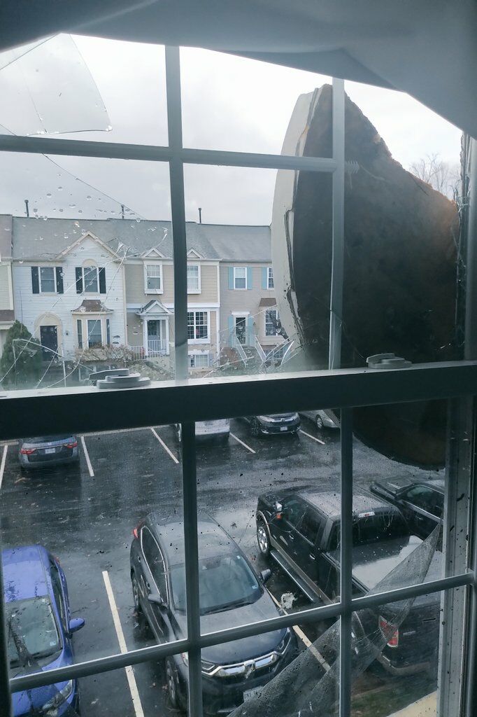
Barksdale Drive, Leesburg @NWS_BaltWash no power being reported. @nbcwashington pic.twitter.com/euZvmqzyLg
— Lauryn Ricketts (@laurynricketts) February 7, 2020
Temperatures on Friday should continue to drop through the 40s into the 30s as winds increase.
Bell said you’ll know when the cold front comes your way — the wind will kick up dramatically. Northwest winds will average 20 to 30 mph Friday afternoon with 50 mph gusts possible.
Wind chills will drop below freezing before sunset. Friday evening will be dry but very blustery and cold.
Grab your umbrella AND your winter coat. One final burst of rain expected this morning ahead of a strong cold front that will push wind chills BELOW FREEZING by sunset. Check out this 6pm wind chill forecast! More information coming up on News4Today. pic.twitter.com/9YHUfKccsc
— Chuck Bell (@ChuckBell4) February 7, 2020
The good news is that the weekend will stay dry from start to finish, Bell said.
“Enjoy the dry weekend because rain chances return for Monday, Tuesday and Wednesday of next week,” Bell said.
Nationally, Friday’s weather destroyed mobile homes in Mississippi and Alabama, caused mudslides in Tennessee and Kentucky and flooded communities that shoulder waterways across the Appalachian region, killing five.
Power Outages
Thousands in Northern Virginia and Maryland were without power on Friday.
Dominion Energy says more than 7,000 customers are in the dark as of 10:45 a.m., mostly in Fairfax, Fauquier and Loudoun counties. That number was as high as 10,000 on Friday morning.
In Fairfax County, outages were due to a crash on Route 7 near South Walter Reed Drive involving downed wires.
Pepco reports 400 customers are without power, down from 1,700 at the peak of the storm.
First Energy is also reporting 4,800 customers are without power in Frederick County.
In the D.C. region, around 700 people were without power on Friday morning after Thursday’s rain.
Check out the power outage maps below for details.
Forecast
After the rain, comes the sun. It will be partly sunny on Saturday with some isolated sprinkles and flurries possible at night. On Sunday, it will be cloudy but dry.
Friday: Mostly cloudy in the afternoon with windy, cold conditions developing.
Saturday: Increasing clouds. Seasonably chilly. Diminishing winds. Highs in the low to mid 40s.
Sunday: Mostly cloudy and seasonably chilly. Some afternoon sun, but highs only reach the mid 40s.
Monday: Cloudy and but warmer with rain. Highs in the low 50s.
Current weather:
Like WTOP on Facebook and follow @WTOP on Twitter to engage in conversation about this article and others.
Get breaking news and daily headlines delivered to your email inbox by signing up here.
© 2020 WTOP. All Rights Reserved. This website is not intended for users located within the European Economic Area.
"severe" - Google News
February 07, 2020 at 09:07PM
https://ift.tt/3bibKru
Severe damage after tornado warnings, thunderstorms rattle DC region - WTOP
"severe" - Google News
https://ift.tt/2OrY17E
Shoes Man Tutorial
Pos News Update
Meme Update
Korean Entertainment News
Japan News Update
Bagikan Berita Ini


0 Response to "Severe damage after tornado warnings, thunderstorms rattle DC region - WTOP"
Post a Comment