
So far, this has been a record-quiet severe weather season in Ohio. However, on Friday we are looking at a more significant severe weather event with the chance for damaging winds, tornadoes and flash flooding.
We’ll be tracking a complex round of storms through the day Friday into early Saturday, so let’s break down what you need to know to prepare for our threat for severe weather.
The entire state is under an Enhanced or Slight Risk for severe storms.
Starting overnight Thursday, a cluster for storms develops in the upper Midwest, northwest of Ohio. This storm system quickly dives through Michigan and northern Indiana into early Friday around 2 a.m.-7 a.m., sinking into parts of western Ohio by sunrise.
Those areas of western Ohio should expect morning storms with gusty winds and heavy rainfall. The threat will diminish by lunchtime as storms weaken into middle Ohio and areas farther east.
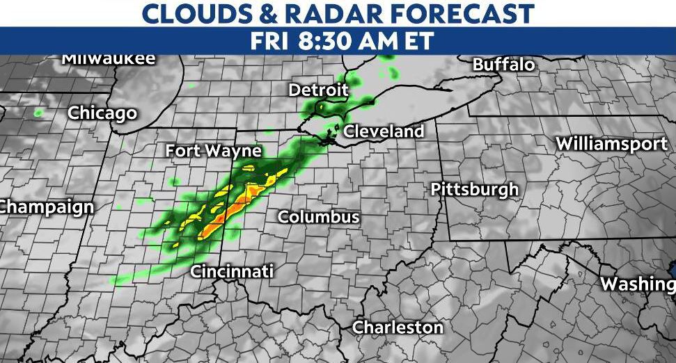
Eastern and southern Ohio may not see any morning storms if the first wave weakens fast enough. However, the second wave expected later in the day will impact more of the state.
After round one of morning storms tapers off, there will be a lull in our activity, most likely late in the morning through early afternoon.
Our atmosphere becomes more unstable as the heat and humidity crank back up Friday afternoon. Temperatures rise into the mid-to-upper 80s with rising dew points as well.
As our air is potentially unstable and more moisture is present, storms will pop then strengthen quickly late Friday.
We're timing out Friday's pop-up storms between 2 p.m. and 6 p.m. Isolated storms begin to fill in and become a cluster of stronger/severe storms after dinner Friday.
This second wave of storms moves through the state into the overnight hours and could bring gusty winds. Wind gusts could push 60-70 mph into Friday night.
There’s also a threat for heavy rainfall with storms late Friday through Friday night. We will be concerned about repeated storms and flash flooding, so make sure you stay weather-aware even after our wind threat diminishes.
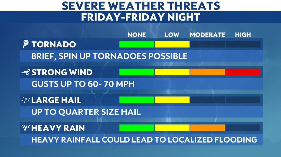
Also, we can’t rule out an isolated tornado or a brief spin-up, but this event mainly poses the threat for straight-line damaging wind gusts.
Severe storms are possible with a second wave after 7-9 p.m., and scattered storms/showers move through the state into Saturday morning.
The severe threat is less but still there on Saturday.
A Marginal Risk is there for severe weather, which means more isolated.
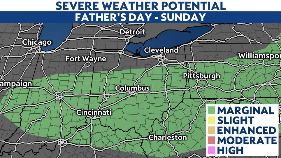
Father's Day will be warm and humid with isolated storms.
Still tracking a few severe storms through Sunday, the threat shifts more south along the front.
More heavy rain and storms are possible on Monday with a strong cold front. Stay weather-aware Friday through Monday.
"severe" - Google News
June 18, 2021 at 07:00AM
https://ift.tt/3gDGYya
Father's Day weekend begins with the return of severe storms - Spectrum News 1
"severe" - Google News
https://ift.tt/2OrY17E
Shoes Man Tutorial
Pos News Update
Meme Update
Korean Entertainment News
Japan News Update
Bagikan Berita Ini


0 Response to "Father's Day weekend begins with the return of severe storms - Spectrum News 1"
Post a Comment