
MID-MISSOURI – May has started to feel more like early April with temperatures only reaching the 60s and 50s in the afternoon. That trend will continue up until the middle of the month and then a new pattern is expected to dominate our region. We expect a bit of winter, spring, and summer all in the month of May 2020.
FROSTY TEMPERATURES
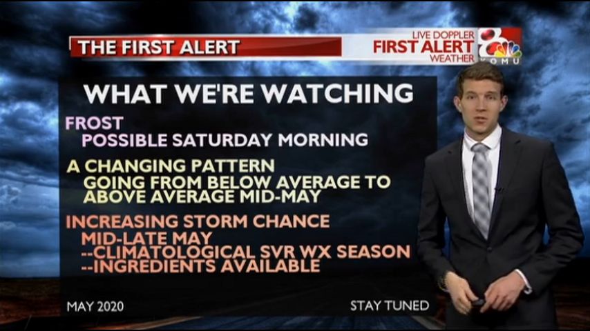
If you’ve already planted your garden or flower beds you’ll want to take the necessary precautions because the morning of Saturday, May 9 we expect temperatures to fall to near freezing allowing for frost to form on exposed surfaces.
This is part of a larger weather system bringing record breaking temps to areas east of Missouri all the way to New England, where inches of snow will be possible.
This is a rare event. For our temps in central Missouri the records are 31º in Columbia set back in 1906 and Jefferson City has a record low of 32º from 1947.
A PATTERN CHANGE
Below average temperatures will continue through Wednesday, May 13th. Then, warmer air is expected to surge north as a warm front breaks our cool pattern. This is expected to occur on Thursday, May 14th with temps reaching back into the 70s. Moisture looks available here too and may lead to thunderstorms.
From May 14th onward temperatures look to be seasonal to above average for the remainder of the month.
SEVERE WEATHER SEASON
While severe weather season begins in Missouri as early as March, the peak is in mid-late May.
In 2020, it appears the peak of the season will also coincide with this changing pattern. This means cool air and warm air will be close together. Those are two ingredients we need for severe weather.
We also expect moisture to be available, adding another ingredient.
Now, we just need low pressure systems to move in from the west and mix all of this together. Will that happen? It is too early to say. But the setup is at the very least in the realm of possibility.
The point here is that you should stay tuned each day with us on KOMU 8 starting the middle of this month, if you aren’t already. Forecasts can change quickly and you don’t want to be caught off guard.
Our goal is for no one the ever be caught off guard. The best way to stay up to date is to watch newscasts and download the KOMU 8 Weather App, making sure station notifications are turned on in the app settings. We send severe weather info days and hours in advance so you know what to expect and when. You can also watch live streaming through the app during newscasts and storm mode tornado coverage.
KOMU 8 is also available on ROKU devices. Check out the new free streaming channel by searching for “KOMU 8” and clicking “Add Channel”.
"severe" - Google News
May 08, 2020 at 08:24AM
https://ift.tt/3caeFm6
Cool temps, frost, severe weather: May is looking like a whirlwind - KOMU 8
"severe" - Google News
https://ift.tt/2OrY17E
Shoes Man Tutorial
Pos News Update
Meme Update
Korean Entertainment News
Japan News Update
Bagikan Berita Ini


0 Response to "Cool temps, frost, severe weather: May is looking like a whirlwind - KOMU 8"
Post a Comment