
Update at 9:36 p.m.
As of 9:30 p.m., CPS Energy is reporting 61 outages affecting 10,329 customers throughout San Antonio.
Update at 9:35 p.m.
NWS has issued a Tornado Warning until 10 p.m. for New Braunfels, Schertz and and Seguin.
NWS' radar has indicated tornados in the area. Hail the size of quarters may be seen.
Update at 9:00 p.m.
Bexar County's Tornado Warning has expired, according to the National Weather Service.
The area will continue to see large hail from thunderstorms this evening.
Update at 8:10 p.m.
The National Weather Service has issued Severe Thunderstorm and Tornado Warnings for San Antonio.
NWS says hail the size of limes are possible, as well as winds up to 70 mph.
Update at 7:40 p.m.
The National Weather Service reports that a tornado has likely touched down just north of D’Hanis, about 50 miles west of San Antonio.
Update at 7:00 p.m.
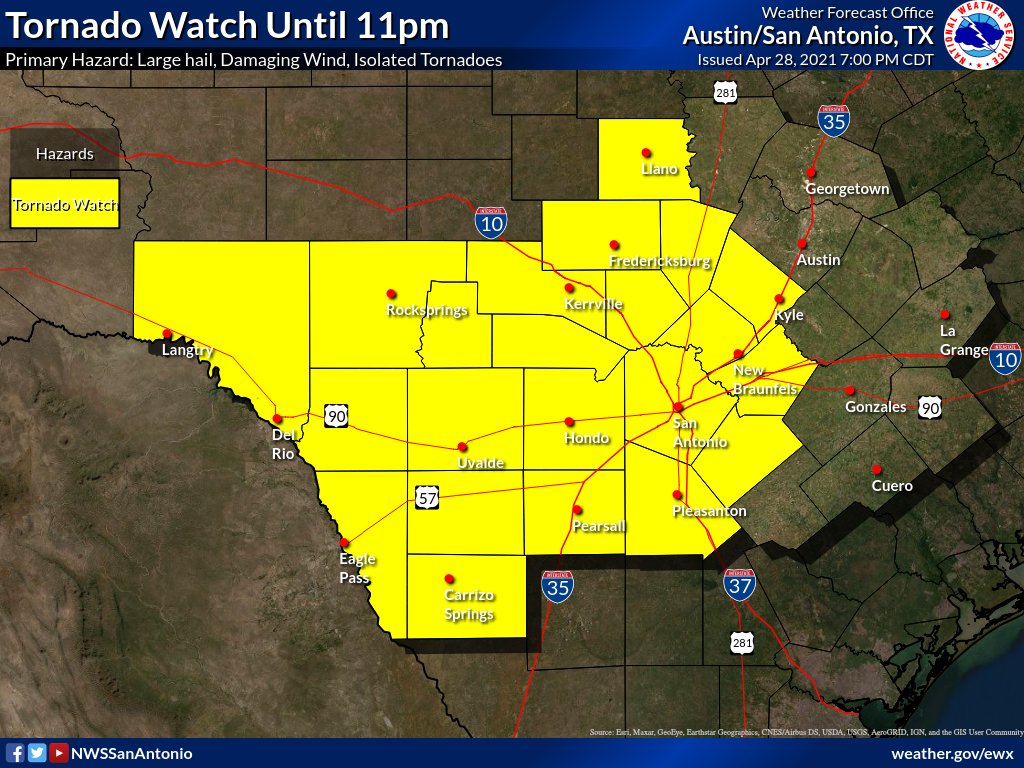
The National Weather Service has extended its Tornado Watch to six additional counties, including Bexar, Atascosa, Comal, Guadalupe, Hays and Wilson.
Update at 4:45 p.m.
The National Weather Service has issued a Tornado Watch until 11 p.m. for Kendall, Bandera and Medina counties.
Heavy rainfall in the Hill Country is still likely Wednesday night with rainfall totals expected to be between 2 to 4 inches and isolated amounts of up to 6 inches possible by Thursday morning.
Rainfall amounts for Bexar County is still expected to range between half an inch to 2 inches. Localized flooding is possible if heavier rain bands develop.
San Antonio will most likely see the rainfall late Wednesday night through Thursday morning.
Previous Story:
There is an enhanced risk for severe weather in parts of the Hill Country on Wednesday night, according to the National Weather Service. The western portions of San Antonio have also been included in the upgraded risk and could see hail as big as 2 inches.
Severe storms will begin to the develop Wednesday afternoon around the Rio Grande then move toward the Hill Country and San Antonio by the evening.
Along with the hail, tornadoes and damaging winds are a possibility in areas such as Boerne, Kerrville and Fredericksburg. Some isolated storms may also be capable of producing hail 4 inches in diameter and rainfall totals of 1 to 3 inches. Isolated rain bands, however, may produce 5 inches of rain through Thursday morning.
San Antonio is expected to see rain, with heavier precipitation in areas west of Interstate 35. Rainfall totals are expected to be between half an inch to 2 inches for the Alamo City.
San Antonio remains in the slight risk category for severe weather.
CPS Energy said it will have crews on standby in the case there are power outages, according to a news release.
“Severe weather can result in tree branches falling on our power lines or other infrastructure damage as well as vehicle accidents that can cause power outages," said Darrell Clifton, Vice President of Construction & Maintenance Services at CPS Energy. "We will work around the clock to restore all outages as quickly and safely as possible.”
CPS is encouraging customers to use its interactive outage map to view power outages in your area.
"severe" - Google News
April 29, 2021 at 10:31AM
https://ift.tt/3vr7m2x
10,329 CPS customers without power after severe thunderstroms roll through S.A. - San Antonio Express-News
"severe" - Google News
https://ift.tt/2OrY17E
Shoes Man Tutorial
Pos News Update
Meme Update
Korean Entertainment News
Japan News Update
Bagikan Berita Ini


0 Response to "10,329 CPS customers without power after severe thunderstroms roll through S.A. - San Antonio Express-News"
Post a Comment