
HOUSTON - Are you ready for a blast of cooler air and some rowdy storms? For about three weeks, we dealt with warmer than average temperatures across Houston. But as we get closer to Spring, things are getting interesting.
After a gorgeous Wednesday, big changes are rolling in over the next 24 hours.
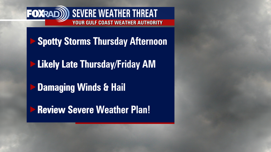
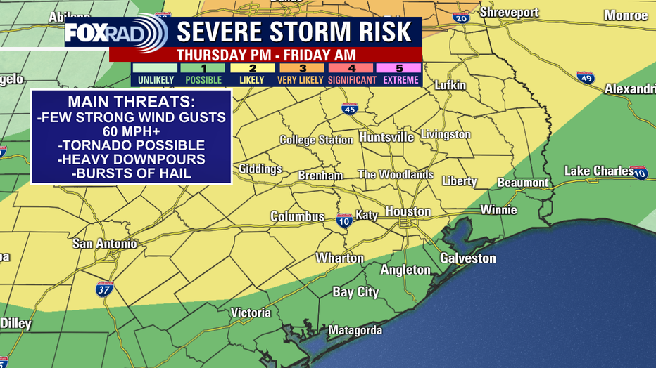
Here's a timeline of what you can expect with the increasing threat for severe weather for Houston and the rest of SE Texas.
Thursday morning - Most of the rain should stay west, but a few showers are expected to build in by mid-late morning. Severe weather is not expected Thursday morning, but a few heavier bursts of rain are possible, especially late morning. Temperatures will be mild in the morning starting off in the 60s and warming to the 70s by late morning.
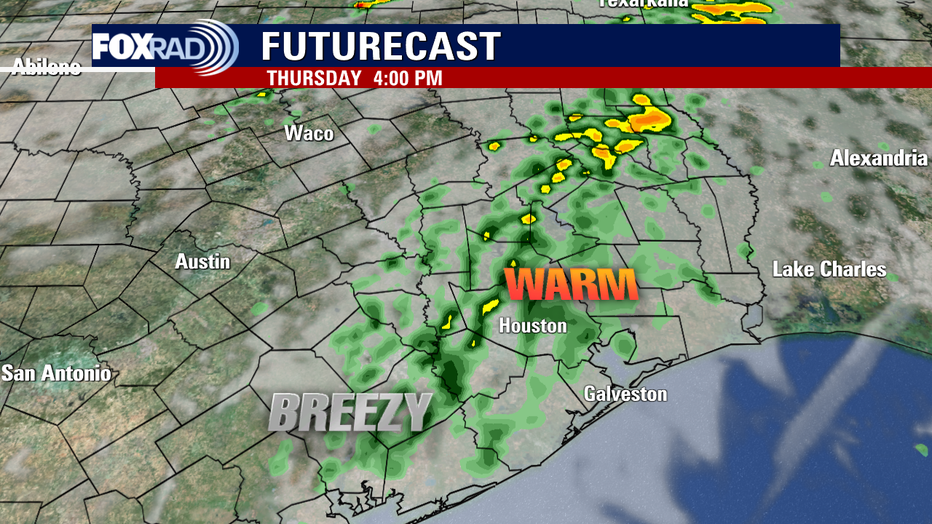
Thursday Afternoon - We should top out near 80 degrees Thursday afternoon as strong southerly winds pump up much warmer air and increase the moisture over the area. Expect Scattered rain and some rumbles of thunder during Thursday afternoon. A few storms could be strong, but the main severe threat should move in late Thursday night into early Friday. It will be windy Thursday PM with south winds of 15-25 mph and gusts near 30-35 mph.
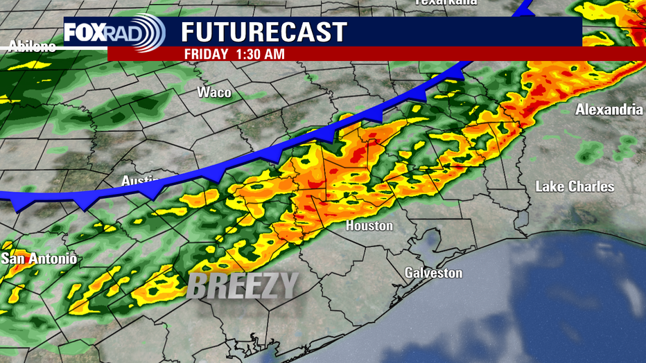
Thursday Night into Friday AM - Main line of storms ahead of cold front should push into Brenham & College Station areas between 10 PM and 11 PM, enter Houston area between 1-2 AM, and reaching Galveston between 3-4 AM. Heavy downpours are likely, along with the threat for some damaging winds, hail and a small tornado threat. Tornado risk is only 2% within 25 miles of a location but still something we will watch closely.
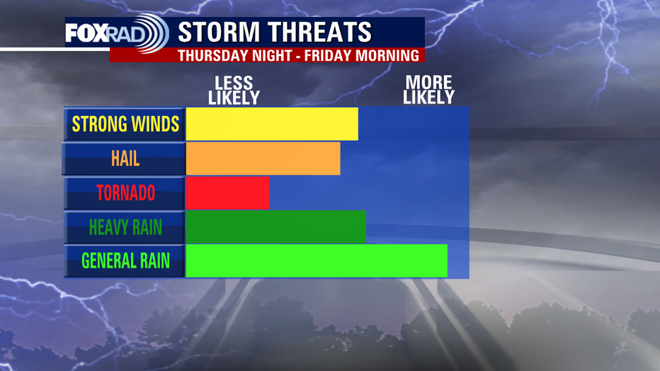
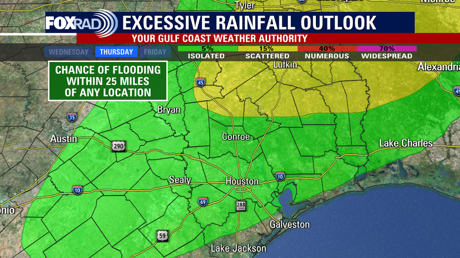
Models are indicating 1-3" of rain possible with the highest risk for flooding staying just north of Houston. Areas farther north such as Huntsville and Livingston will have the biggest flood threat. Remember, always avoid driving across any flooded roads and find an alternate route!
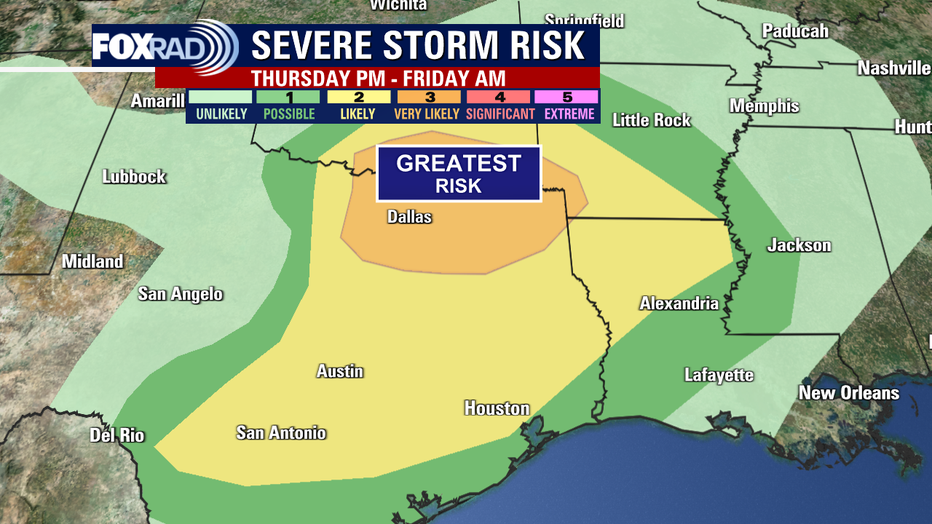
Storm prediction center has the biggest severe storm threat staying in north Texas and southern Oklahoma. But SE Texas remains in a Cat. 1 out of 5 lower threat along the coast and a Cat. 2 out of 5 threat farther inland for Houston and areas north.
If your St. Patrick's Day outdoor plans are outside during the second half of the day Friday, you may have the luck of the Irish on your side. Friday morning will be wet and stormy but we should dry out for Friday PM. Temperatures will be chilly all day starting of in the upper 50s early Friday, low/mid 50s by afternoon and 40s by evening. Add in wind gusts near 30 mph, and it will feel even colder for your Friday night plans! Wind chills will dip into the 30s!

Chilly Air should stick around through early next week which means a cool start to the spring season!
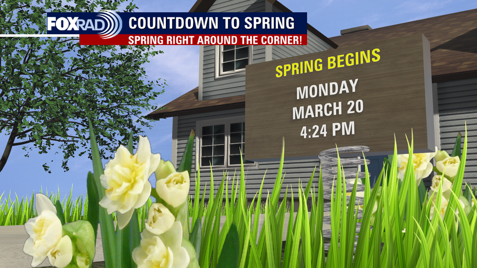
Spring officially begins at 4:24 pm Monday.
Make sure to download the FOX 26 Weather App to keep track of all the weather changes coming our way!
"severe" - Google News
March 16, 2023 at 08:04AM
https://ift.tt/pjg7VTw
Houston weather: Severe weather possible across area Thursday night-Friday morning - FOX 26 Houston
"severe" - Google News
https://ift.tt/uk1ZlSx
Shoes Man Tutorial
Pos News Update
Meme Update
Korean Entertainment News
Japan News Update
Bagikan Berita Ini


0 Response to "Houston weather: Severe weather possible across area Thursday night-Friday morning - FOX 26 Houston"
Post a Comment