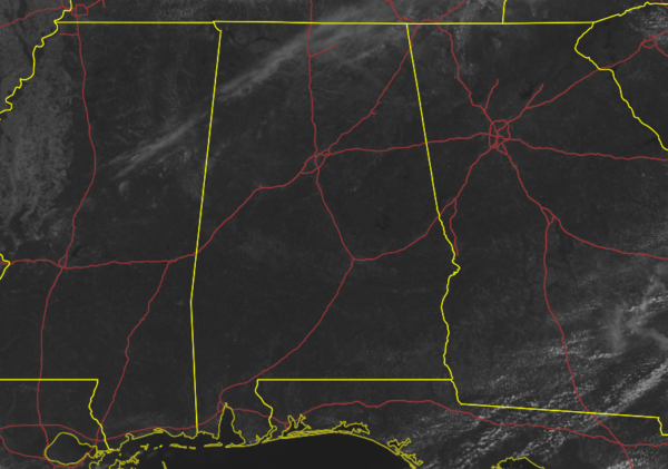
REST OF TODAY: After the cold front and showers moved through the area during the late-night and predawn hours, your Friday has turned out to be really nice, with only a few thin high clouds floating over the northern parts of the area. The radar is free from any precipitation as dry air continues to move into North-Central Alabama. As of the 11 am roundup, temperatures across the area were in the lower 60s to the mid-70s across the area. Haleyville was the cool spot at 62 degrees, while the warm spot was Troy at 76 degrees. Birmingham was at 67 degrees.
Skies will continue to be mostly sunny to sunny across the area through sunset, with afternoon highs reaching the upper 60s in the northwest to the lower 80s in the southeast. For tonight, skies will be clear with temperatures dropping from the lower 60s to the lower 70s at 6 pm, to the lower 50s to the lower 60s by 10 pm, and into the mid-40s to the lower 50s for the overnight lows.
THE CENTRAL ALABAMA WEEKEND: Sunny skies can be expected throughout the day on Saturday with temperatures topping out in the mid-70s to the lower 80s across the area, before dipping into the upper 50s to the mid-60s by 10 pm, and bottoming out in the upper 40s to the upper 50s. Sunday will be fantastic once again as highs will be in the upper 70s to the mid-80s.
SEVERE WEATHER POSSIBLE NEXT WEEK: A quick moving system will move through the area on Monday that will bring some showers and storms to the area. While a strong storm or two may be possible, severe weather doesn’t look likely at this juncture. Tuesday will be a nice day with a good bit of sunshine and no rain.
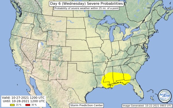
However, we do note that the Storm Prediction Center has highlighted the southern half of the state in a 15% probability for severe storms on their day 6 outlook, which equates to a slight risk on Wednesday. It is too early to discuss the specific timing and threats at this point, but a strong cold front with good upper air support and strong wind fields will move through North Central Alabama with the potential for severe storms. We are getting very close to the start of our tornado season (Nov. 1st), so now is the time that we really need to start watching these incoming systems for that potential. We’ll have to see if this area expands over the next few days, or if it will be refined to more along the Gulf Coast.
After that, the Halloween weekend looks to be fantastic with dry air, cooler temperatures, and mainly sunny skies. Nearly ideal weather for trick-or-treating or sitting outside by a freshly stoked fire pit with marshmallows ready to be roasted.
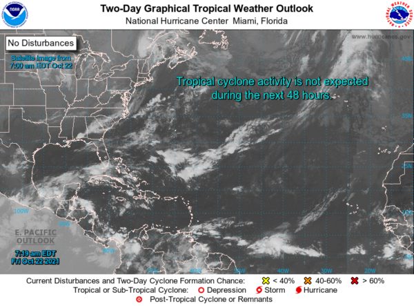
THE TROPICS: The tropics remain astonishingly quiet, and no new tropical cyclones are expected to develop within the next five days. Remember, the end of the season doesn’t arrive until the end of the day on November 30th.
Category: Alabama's Weather, ALL POSTS, Severe Weather, Tropical
"severe" - Google News
October 23, 2021 at 12:16AM
https://ift.tt/3nBrj4L
A Great & Rather Warm Weekend Ahead; Severe Storms Possible by Mid-Week - alabamawx.com
"severe" - Google News
https://ift.tt/2OrY17E
Shoes Man Tutorial
Pos News Update
Meme Update
Korean Entertainment News
Japan News Update
Bagikan Berita Ini


0 Response to "A Great & Rather Warm Weekend Ahead; Severe Storms Possible by Mid-Week - alabamawx.com"
Post a Comment