
Editor’s note: Norton Peak is the first in a series of worthy but unsung recreational areas that Phil Brown is exploring on private lands for which New York has purchased conservation easements that provide public access.
By Phil Brown
If the ever-growing popularity of the High Peaks proves anything, it’s that hikers love a mountain with a view. It stands to reason that one way to reduce overuse is to create new trails to summits outside the High Peaks.
A trail over Norton Peak and west to Haystack Mountain and Wolf Pond Mountain in the Sable Highlands could be just such a draw—a moderately strenuous hike to three peaks with wide-open views of the northern Adirondacks. (This Haystack should not be confused with those in the High Peaks or Ray Brook areas.)
The state Department of Environmental Conservation proposed creating this trail in a 2009 interim recreation plan for the Sable Highlands. But more than a decade later, the trail still does not exist. Spokesman David Winchell said DEC has not abandoned its plans for the trail, but he offered no timeline for its construction.
Although the Sable Highlands are commercial timberlands, the state owns a conservation easement that protects them against development and that permits some public access. DEC’s recreation plan designates 14 “public use areas” open for hiking, biking and cross-country skiing, among other activities.
In 2008, New York State paid $10.8 million for conservation easements on 84,000 acres of commercial forest known as the Sable Highlands in the northern Adirondacks. The deal lets logging continue, but it also allows public recreation in 14 “public use areas,” totaling 21,100 acres, and on “linear recreation corridors” connecting them. The state so far has failed to implement much of its plan. This spring, the Adirondack Explorer spent many days exploring the Sable Highlands on foot, by car, and on a mountain bike. This is one in a series of articles meant to open a window on a land partly owned by the public but rarely seen.
Since Norton Peak is in the Cold Brook Public Use Area, you are allowed to bushwhack to the 2,870-foot summit. Without a trail, though, you can’t continue to Haystack and Wolf Pond Mountain as this would necessitate leaving the public use area and crossing easement lands that are not open to the public. If and when the trail is built, it will be designated a “linear recreation corridor.” People then will be allowed to hike to the other two summits, but they will have to stick to the trail.
There is an irony in the current state of affairs. Norton’s summit is on private land, but it’s open to the public. Haystack’s summit lies within an isolated parcel of state-owned forest preserve, but it remains inaccessible. Part of Wolf Pond Mountain is on another isolated parcel of forest preserve. Thus, the trail would let citizens actually visit lands they own.
I first hiked to Norton Peak in April and wrote a short piece for the Explorer about the astounding abundance of moose scat I encountered. The bushwhack was fairly straightforward. In fact, given the absence of leaves on the trees, I could see Norton’s ridge line as I ascended the south slope. I really didn’t need a compass. It almost felt like cheating. So I returned in June after leaf-out.
Both hikes began at the Cold Brook parking area off Standish Road north of Clayburg. In the two months between my visits, only four parties had signed the register, all locals. Three of the parties listed Norton Peak as their destination.
Norton’s summit lies due west from the parking area. You could set your compass bearing accordingly and head straight up the ridge line. I chose a different approach. From the west end of the parking area, I found a faint path that follows an old logging road that’s now overgrown with bushes and saplings. After 0.6 miles, I left the path and bushwhacked up the south slope to the ridge and then followed the ridge to the top. This way is slightly longer.
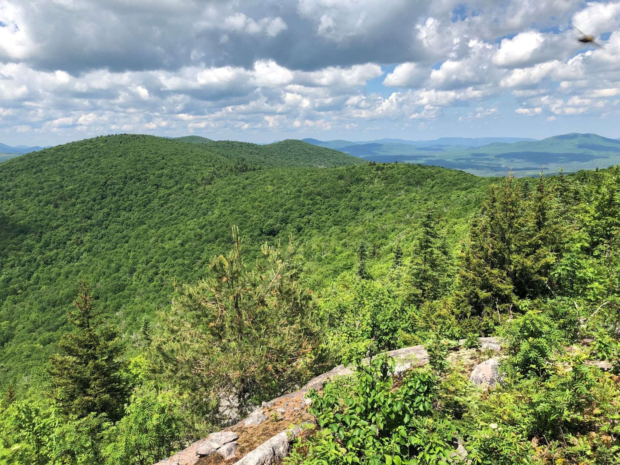
I reached the summit in 2.2 miles, ascending about 1,700 feet, and enjoyed a view south toward Whiteface Mountain and, farther away, many other High Peaks, including Mount Marcy and Algonquin Peak. I found an even better lookout from ledges a bit west of the summit, affording a vista of the Sable Highlands and numerous mountains beyond. You may have to hunt around for the view, but it’s worth the trouble.
Solitude is one of the joys of bushwhacking. I didn’t see anyone on either of my hikes. If DEC builds a trail, Norton Peak no doubt will attract more visitors. As much as I’d like to keep the mountain to myself, that’s a good thing. The public deserves to see what its tax dollars are paying for.
Few trails outside the High Peaks region go over multiple summits, and none exists this far north. A trail over Norton, Haystack and Wolf Pond Mountain, covering 6 miles or more, would offer hikers a spectacular adventure and showcase a part of the Adirondack Park that’s seldom seen.
Build it, and they will come.
Directions: From its junction with NY 3 in Clayburg, drive on Standish Road for 6.0 miles to the Cold Brook parking area on the left.
"peak" - Google News
July 19, 2020 at 06:01PM
https://ift.tt/2WBUlUZ
Norton Peak offers sweeping views, but no trail - Adirondack Explorer
"peak" - Google News
https://ift.tt/2KZvTqs
https://ift.tt/2Ywz40B
Bagikan Berita Ini


0 Response to "Norton Peak offers sweeping views, but no trail - Adirondack Explorer"
Post a Comment